This hike is NOT a typical Capitol Reef National Park hike. The scenery, vegetation, rocks and land use are all different. It is a nice shortish hike for people who have seen much of Capitol Reef and want to walk in some different ecosystems.
| TIME: | 5-7 hours. |
| ELEVATION GAIN: | 500 feet. |
| DIFFICULTY: | Moderate route finding. Easy+ scrambling. |
| MAPS: | Wagon Box Mesa, Bitter Creek Divide |
| GEOLOGY: | Mancos Shale with views of the Waterpocket Fold. |
| PLANTS: | Some different ones. |
| CIRCLE TRIP: | Yes. |
| ACCESS: | From the Visitor Center drive 9.2 miles east on Utah Highway 24 to the signed Notom Road. Turn right (south) and drive 13.6 miles south on the Notom Road to Sandy Ranch Junction. Bear right (south) and drive 18 miles (pass the Park entrance, the campground and Bitter Creek Divide on the way.) Park (P) (6.4 miles south of Bitter Creek Divide) beside a break in the cliff on the left (east) where an old cattle pond has been breached and Tamarisk still grow. |
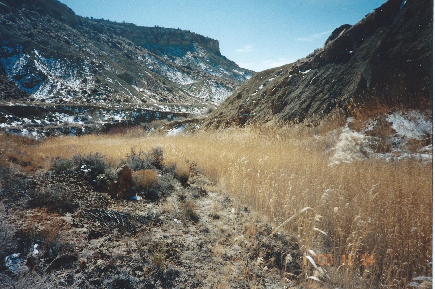
Walk east from the road past the Tamarisk trees. The dam is at the very top of the Morrison Formation in bentonite clay. The cliff is formed by the Dakota Sandstone and the cliff line is locally referred to as Oyster Shell Reef. At the north end of the cliff break a cattle trail goes over the old dam and then heads left (northeast). As you cross the rocks just east of the dam the fossils are obvious. The Dakota is only a few feet thick here, and all the remaining rock traversed on this hike is part of the Mancos Formation.
Follow the cattle trail for one hundred feet to where there is a view north along the right (east) side of Oyster Shell Reef. The rock layer the cattle trail is on is the Tunuk member of the Mancos. The first small sandstone ridge to the right (east) of the Dakota is the Ferron Member of the Mancos.
Turn right off the cattle trail and walk east 100 yards or so to the main wash (cross one minor wash on the way) and head upstream (north). Stay in the main wash or follow animal trails close to the wash for the first mile, then take your best shot.
Not long after entering the wash, the Ferron ridge will be to the west and for quite some time the hike will be crossing the appropriately named Blue Gate Shale member.
Bitter Creek Canyon is the first canyon to the east as you walk north. Animal trails will go in many directions. Some are worth following and others not. At times it will be best to walk well above the wash and at other times in the wash. The ridge on the left (north) side of the wash is best for the last half mile to the Park boundary.
At that boundary and before, the ridge on the skyline to the north and south is formed by the Emery Sandstone member of the Mancos Formation.
A short fence and posts mark the Park boundary. Not far above the boundary the canyon splits and the route goes left (north). Near that junction look at the sky line of the left side of the left fork. There is a rock window on the skyline and the route eventually gets to the level of that window a number of yards to the left (west). The trails become increasingly steep and brushy.
Just after the junction the somewhat faint trail crosses the wash to the left (west) side and climbs up to the first bench level. Every time the bench ends the trail goes up again somewhere until reaching the top of the first sandstone layer. From there a steep narrow trail goes down to the bench below where droppings and a trail may be visible. Domestic cattle do not walk in country that is this rough, Bison do. The trails here and ahead are made by the Henry Mountains Bison herd which roams freely year round.
After half a mile of struggling up and down the terrain smooths some and the walking becomes much easier. Stay on the left (west) side of the wash and east of the cliff on the left (west). As the route approaches a dark brown rock covered butte in the middle of the valley the ridge on the left (west) ends at a side canyon (B) coming in from the west. Follow along below the ridge and go down into that first side drainage. Go left upstream.
The wash will soon climb steeply (north {right} side is easiest) to a higher bench level then split on that bench. Follow the left (south) fork until it comes to an end at the edge of a Pinyon, Juniper grove. At that point there is a low cliff on the north (right). Walk west northwest through the trees keeping the rock band on the right (north). At a ten+ foot high ridge of rock, walk up and across the top of the gentle ridge to where the next canyon north (Bitter Spring Canyon) is visible.
From the top of the ridge walk a bit to the right (north) of west to the top of a cliff line then go north (right) until there is a comfortable way down (C).
While walking the cliff line notice the slope and cliff to the north. The slope is composed of the last (top) layer in the Mancos, the Masuk Member. The cliff above that is the Mesa Verde Formation
Once through the cliff band follow any wash down to the main canyon and the main canyon to the beginning of the trip. There is an old roadbed much of the way down canyon on the right (north) side.
Caution! Once back down in the main (Halls Creek) valley stay with the animal trails and wash to go south. An attempt to go west to the road and walk it could lead to the edges of deep, vertical walled gulleys and a bad trip. Wait until opposite the mouth of Bitter Creek canyon or farther south before going west.
 | ||
23June2017
|
Email: | |
