Chapter Two is made up of six hikes that start from the Notom Road between Highway 24 and Pleasant Creek. After turning south on the Notom Road off Highway 24 there is a hill to climb. At the top of that hill the closest portion of the Waterpocket Fold is sometimes called the Cinnamon Rolls.
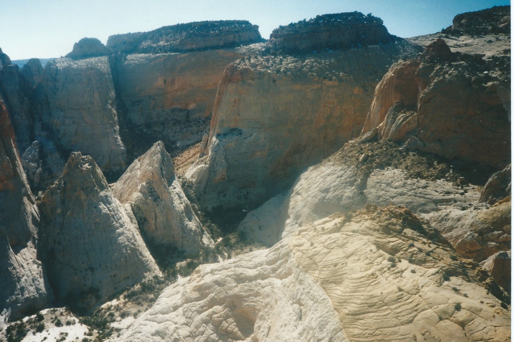
They are a fantastic collection of sandstone monoliths with deep generally hikeable canyons between and around them. Located just south of Utah 24, west of the Notom road and north of Pleasant Creek, they are composed of Navajo sandstone and topped with colorful Carmel Formation rock layers.
Many of the drainages, flowing east between the monoliths, amble through acres of Navajo sandstone speckled with Ponderosa Pines and brilliant green Manzanita. From the Notom road the canyons pass through the brown Entrada Formation then wind through the Carmel, showing different faces of rock type. The Calf Canyon circle trip is the most strenuous.
 | ||
23June2017
|
Email: | |
