This hike offers a lot for a relatively short hike. Early in the hike is the most difficult "scramble", though not the most dangerous one, in this book. There is also a walk along a flowing stream, some slot canyon time, interesting country and nice views at the top. There are lots of opportunities for long or short exploration trips.
| TIME: | 7-9 hours. |
| ELEVATION GAIN: | 1200 feet |
| DIFFICULTY: | Easy route finding. Difficult scrambling. |
| MAPS: | Notom, Golden Throne |
| CIRCLE TRIP: | No. |
| ACCESS: | From the Visitor Center drive 9.2 miles east on Utah Highway 24 to the signed Notom Road.
Turn right (south) and drive 6.1 miles to the top of the hill where an unsigned two-track dirt road goes off to the right.
Turn right (west) and go a total of 1.7 miles.
At 0.7 miles go right.
At 1.0 go straight at a couple closely spaced junctions and drive down over the rocky section (a high clearance vehicle required).
At 1.5 go either way, and 0.2 miles later park (A) before another junction. Note: Roads of this type change over time. Check your map to end up in the right place. |
Walk to the road junction and go left following the road around a left hand curve and down to Pleasant Creek. Once at the creek walk up the streambed or along the bank.
Ten minutes up there is a bumpy bedrock section. The rock is part of the Carmel Formation, the same formation the creek has been flowing in since the hike started.
Just around the corner from the rock section is a water diversion into an irrigation ditch. Water diversion and irrigation at Notom predate the establishment of water rights in the state of Utah. Needless to say Notom has a primary water right.
As Pleasant Creek rounds the first bend to the left (west) above the diversion it flows over the contact between the Carmel and Navajo Formations.
The fence ahead has a gate on the left (south) side of the creek. Growing in that fence on the left (east) side of the gate is a sharp, holly leaved, Barberry bush and to the left of it is a Fringed Sage.
Thirty minutes into the hike the creek runs against a cliff on the right (north) side of the valley forcing hikers to cross the creek. Cross it, but very soon re-cross it and follow a trail up and over a low ridge to the southwest. This cuts off a big bend in the stream channel. At the top, just one step beyond the rock at the pass there is a gnarly old Littleleaf Mountain Mahogany shrub on the right. The main grass growing in that area is Indian Rice Grass.
Ten minutes beyond the pass there is a major split in the canyon. The creek turns right and goes northwest though what appears to be the largest valley goes straight (west). Leave Pleasant creek and walk west (straight) up the dry tributary drainage.
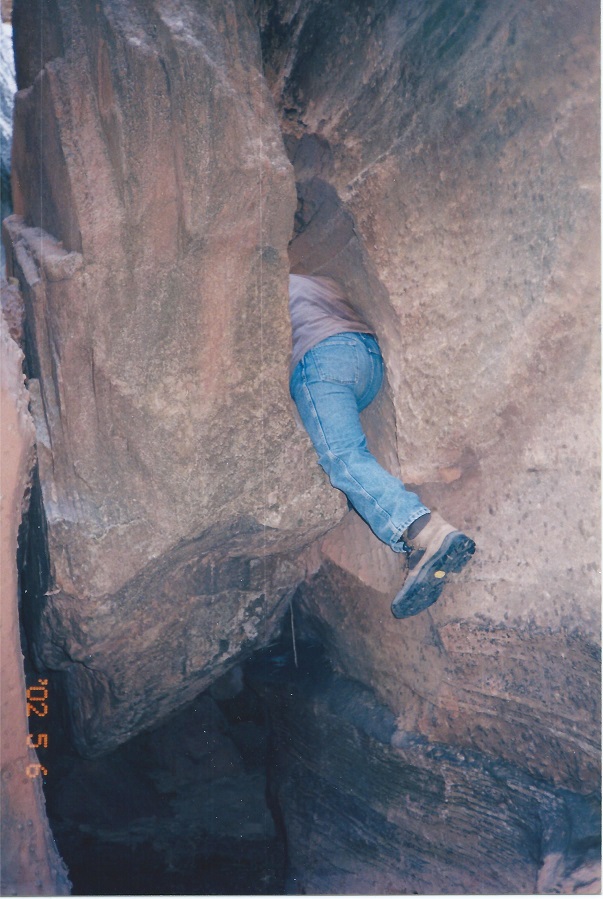
Five minutes up there is a wash junction. Go right (west). Three Canyons Canyon (PN) will soon narrow to as little as ten feet wide. The first bush up on the right is a red barked Serviceberry and the first trees growing in the wash are Boxelder. The canyon will narrow for a second time and there may be a small water hole in the slot. At the end of that slot go left (south) at the wash junction and continue to a challenging chockstone. (B)
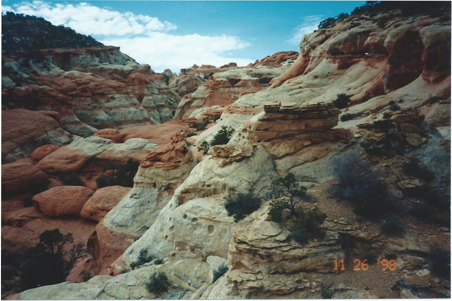
Near the end of the first large open area above the chockstone the red brown Kayenta formation shows up at wash level and slowly climbs the canyon wall. Normal rock formation colors are mixed in this area (the Kayenta will be tan in some places).
Twenty minutes farther there will be a series a water holes and smallish pour-overs with slickrock ramps on both sides. Go up the right (north) ramp. After 100 yards, return to the wash on a comfortable sloping ramp.
Fifteen minutes later, crawl through a short tunnel and climb out either hole in the roof. Leave the wash here and climb the right (north) side of the canyon to get around the next pour-over.
Soon after returning to the canyon there is a major fork. (C) Take the right (north) fork to the top. Just after the junction, there is a pour-over where the route goes up over the pointed rock and just beyond that, up a tree root past another pour-over.
From there, explore. The main wash does not go through to the west rim but is an interesting maize.
To get to the top leave the main wash on the right (north) side. (D)
 | ||
23June2017
|
Email: | |
