LIZard Canyon is an amazing canyon with an interesting approach and a nice arch. All hikes have strong points and weak points. This one packs a lot of strong points in a short distance once you leave the valley trail. The weak point would be the length of time spent on the valley trail but for people who do not frequenty walk the Halls Creek valley even that is not very weak. Be prepared for slickrock walking and contorted country.
| TIME: | 8-10 hours. |
| ELEVATION GAIN: | 2500 feet. |
| DIFFICULTY: | Moderate route finding. Moderate scrambling. |
| MAPS: | Deer Point, The Post |
| GEOLOGY: | Walk and observe Fold structure. |
| PLANTS: | A large variety |
| CIRCLE TRIP: | No. |
| ACCESS: | From the visitor Center drive 9.2 miles east on Utah Highway 24 to the signed Notom Road. Turn right (south) and drive 13.6 miles to the Sandy Ranch Junction. Bear right (south) and drive 19 miles to the Burr Trail Junction. Go straight (south) and drive 11 miles toward Bullfrog to a signed junction. Turn right (west) on pavement and drive 0.8 miles to a signed junction. Turn right (west) toward Halls Creek Overlook. CAUTION If this road is wet do not attempt it even with 4-wheel drive. The road is a bit rocky in places and has lots of clay on hills. Park near the pavement if the ground is wet. Drive 2.6 miles to another signed junction. Turn right (west) and drive 0.3 miles (of bad, high clearance road) to Halls Creek Overlook (H). |
Walk one mile down the Halls Creek Overlook Trail to the wash at the bottom. Turn right and walk north on the right (east) bench beside the wash. The main valley trail will show up toward the north end of the first rock hill on the right. Follow it past Hamburger Rocks and Muley Tanks for a total of three and one half miles to where the trail crosses Muley Twist wash. Along the way there is a sign and spur trail to Muley Tanks. Muley Twist wash is three quarters of a mile past that sign on the main trail. Early in that three quarter mile walk LIZard Canyon Wash crosses the trail. Following the wash is not an option due to pour-overs and following the north rim, though possible and fun, is confusing. The best route is to go all the way to Muley Twist wash and leave the trail there.
The last few yards before the trail goes into Muley Twist Wash there is a lot of old drift wood beside the trail. Near the wash crossing (X) turn left (west) and walk up slope to the top of the ridge of red brown rock. Bear right and follow that red rock ridge to its' highest point, just a couple hundred yards.
From there pick out the broad vegetated saddle in the Navajo Sandstone a quarter mile ahead to the west northwest. Beyond the saddle some brown stain can be seen on the smooth cliff wall of Muley Twist Canyon. Walk to that saddle.
Next, look west and pick out the lowest saddle (A) in the ridge between Muley Twist Canyon and LIZard Canyon. The red brown rock visible above the saddle is well back in Muley Twist Canyon. To get to the saddle, walk to the right (northwest) to the edge of Muley Twist Canyon then turn left (west) and walk that edge to the saddle.
From this low saddle between Muley Twist and the sweep of LIZard Canyon stay well above the LIZard slot canyon and walk west, bending slowly around to left (south). Explore the great expanse of Navajo as much as desired but the route stays 200 to 300 yards west of the slot.
Eventually, fifteen minutes+ from the saddle, LIZard canyon turns and heads west toward you, makes a couple close turns, then heads pretty much due south. The entrance to upper LIZard Canyon follows a side drainage southeast into the canyon about where LIZard Canyon makes its last bend and goes south for quite a distance.
Walk west up the slickrock until in the drainage that enters LIZard Canyon near the beginning of its run south. Work down into the main wash (PN) LIZard Canyon. Once in the wash the route is obvious. Three minutes up the wash there is a nicely shaped arch (LIZard Arch) on the right (west).
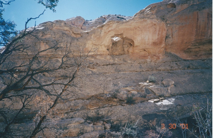
Just beyond the arch the wash rounds a corner and you get a great view of a large high mass of atypically weathered Navajo Sandstone on the right (West). The steep rounded mass of rock is quite smooth while most Navajo Sandstone sloped masses like that are broken up and roughed up by a joint pattern (cracks). Once through the Navajo the canyon just spreads out and to continue in any direction (E) requires a climb. Explore! The view from the top of the canyon rim is spectacular. The rim can be attained by going south through the red/brown Kayenta Formation or by going northwest within the same rock layer. The Wingate Sandstone is too steep for normal walking but as you look at the impressive slope of Wingate notice that most of it is a tan color. Typically the Wingate is red/orange in Capitol Reef National Park and most places on the Waterpocket Fold. That Wingate slope also shows the Waterpocket Fold at its steepest.
 | ||
23June2017
|
Email: | |
