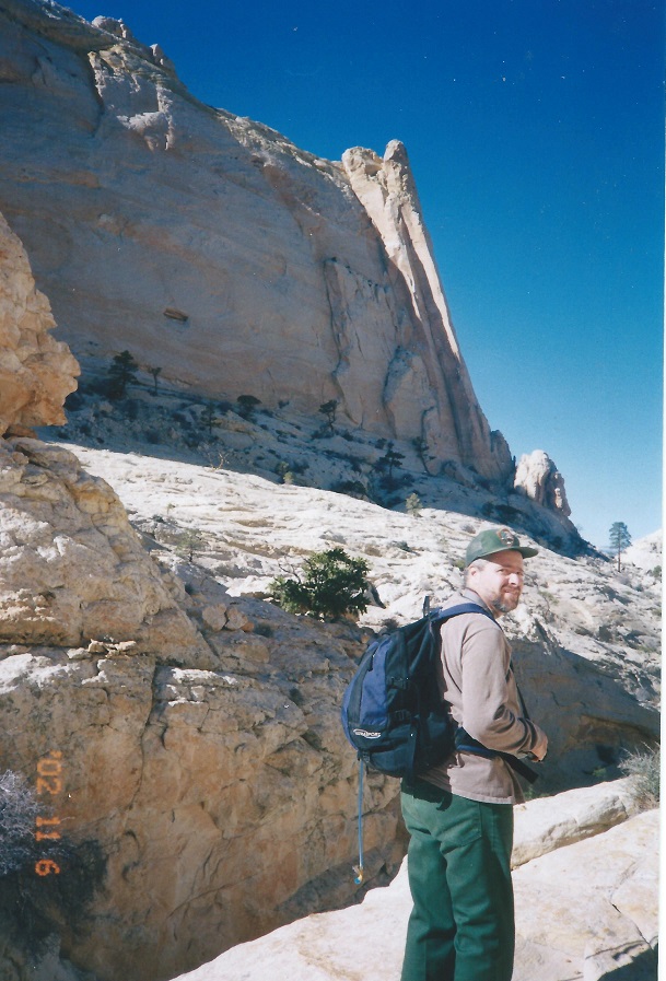
The hiker is Randy Saddler. We will find Saddler Arch in a future route.
A strenuous hike that travels three canyons and crosses two passes. This hike is short on distant views (There is one excellent one) but makes up for it by traveling through some neat country. The scrambling on this hike is not extreme but is tricky and interesting. This would be a good hike for anyone looking for places to explore on their own. Two areas touched by this hike beg to be returned to and explored.
| TIME: | 8-10 hours walking from the Park boundary. |
| ELEVATION GAIN: | 1400 ft. |
| DIFFICULTY: | Moderate route finding. Moderate+ scrambling. |
| MAPS: | Golden Throne, Fruita |
| GEOLOGY: | Entrada, Carmel, Navajo. Look for highly fossiliferous pink or grey rocks containing small clam shells. They come from a layer high up the canyon walls in the Carmel Formation. |
| CIRCLE TRIP | This is a through trip requiring a drop off, pick up or a vehicle at both ends. A second vehicle should be parked at the east end of the Grand Wash road from the Scenic Drive. |
| ACCESS: | From the Visitor Center drive 9.2 miles east on Utah Highway 24 to the Notom Road. From that junction, drive south on the Notom road 1.6 miles to a two-track on the right (south). Turn right and follow the track 0.5 miles to an area where people occasionally camp. (A) If you do not have a 4-wheel drive vehicle, park here. If you drive on, bear right (south) and drive into the wash. Drive up the wash about 0.1 miles to a "T" in the wash. Go left (south) and drive 1.1 miles to the Park boundary. Leave your vehicle there. (B) |
The hiker is Randy Saddler. We will find Saddler Arch in a future route.
From the Park boundary, walk northwest up the wash. There will be a cliff on the left (southwest), and at the first break in that cliff, turn left (southwest) and walk up the rock ramp. In just a few yards you will come to the main wash again; you have thus cut off a 1/4 mile walk. Go up the main wash - or cut the corners as the cattle and game trails do - for about thirty minutes to the first large (40 foot) pour-over.
along the way
As you walk, the rocks around you are changing in color and texture. It is all Carmel Formation. Go around the pour-over to the Wright (north). In another fifteen minutes or so there will be a "T" junction in the wash. Just before that "T" the rocks in the wash turn to the light tan color of the Navajo Formation.
At the "T" junction (C) turn right (north) and head up canyon. The predominant bushes there at the "T" and just beyond are Apache Plume. There are also at least two types of grass in the wash, the straw colored one with tiny balls on the stems is Indian Ricegrass and the copper colored grass is called Copper Grass or Big Bluestem. After fifty yards the canyon closes in for a short distance, then widens out some for another fairly short distance (less than 100 yards). Just before the canyon starts to narrow for the second time, there is a drainage coming in from the right (north). (D) Go up that drainage (thirty vertical feet) to the top of the red rock layer and turn left (west), heading, again, up canyon.
Digression: The canyon bottom is interesting but eventually becomes impassable. Explore and enjoy.
As you walk the top of the red rock layer the main plant is Mormon Tea. Most of the way along the red layer there is a game trail to follow. After winding around three or four side canyons you come to a point where there is a good size basin in front of you and the red layer turns right (north) along the edge of the basin. Below, there is a deep rock basin water hole and north of that a cliff enclosed area with Cottonwood trees. Should you wish to go down to that area, there is a route right off the point where the red layer turns from heading west to heading north.
To continue the described route, follow the red layer north for a ways but soon (E) start to go down toward the wash. If you are unsure, the red layer becomes un-walkable so you will be forced down anyway. Once in the wash again, head up stream. Ten minutes after re-entering the wash there is a place where the canyon splits into three canyons. The southern-most canyon splits off to the left (south) first.
Digression: The southern most of the three canyons is an interesting canyon to hike. There are numerous water holes within the first five minutes up the canyon and, again, about 45 minutes up canyon. The center canyon is also an interesting and challenging canyon to hike. Both are dead ends.
Go right (straight) at that first wash junction. Very soon you reach the middle canyon/north canyon junction. (F) Again go right (north) and bounce your way up canyon around small pour-overs and water holes.
About forty-five minutes up canyon from the three canyon junction there is a large Ponderosa Pine right next to the wash.
There are more large trees in the next three to five minutes, then a large triple topped one. Surrounding that tree are numerous Manzanita bushes with bright green leaves and red bark.
Beyond that is a high pour-over. (G) The quickest and easiest way around the pour-over is to the left (south) but it also has the most exposure. You can get around with less exposure by going to the right but you are forced to climb well above the top of the pour-over and then come back down.
Forty-five minutes beyond the pour-over there is a basin with a huge wall of Navajo Sandstone in front (west) of you. Walk through the basin until very close to that wall. You will eventually see there is a low saddle at the right (north) end of that wall. Turn right (north), walk through the saddle, (H) and work your way down into the next major east/west wash. As you start down stay somewhat to the right (east) and work your way through the first cliff band. Once below that there is no real problem getting to the main wash below.
In the major wash, head left upstream passing some minor junctions. About twelve minutes up the wash is an obvious junction. Follow the main wash to the right (north). After that junction work your way up the right side of a small pour-over and where the wash splits again go right (north). Fifteen minutes beyond that second right the drainage will open up. There will be Navajo cliff walls to the right (east) and to the left (west), and a couple Navajo domes and notches straight ahead (north). The drainage you have been following makes a 180 degree turn to the left.
Do not make the turn, (I) leave the wash and go north. The two reasonable notches ahead have ponderosa pines growing in or near them. The East notch is higher and has a dead topped ponderosa just below it. That is the one you want (E) though the lower one works. Enjoy the view at the notch (J).
From there, WORK your way down. You are descending Bear Canyon. It is a really fun descent. About fifteen minutes down you will come to a slot that you can see descends a long way. Step left and go thirty-five+ yards out a dirt and brush covered ridge (L). Angle right (northeast) and work down beside the slot to the wash.
About thirty minutes down from the notch, Bear Canyon widens a bit and the wash bottom becomes bedrock. Near the end-of the bedrock (M) the wash turns left and drops out of sight, headed right toward a huge dead tree protruding up from the canyon below. Where the wash turns left, continue straight (G) (north) and take the easy, almost level, slickrock walk staying fairly close to edge of the canyon on the left. After about 150 yards a vegetated bench will come into view ahead. The route follows that bench to the end. Small, but somewhat deep, washes cross the bench, particularly early in the walk, and are most easily passed on the right (east) side near the cliff wall.
After ten minutes, keep an eye on the right hand (east) wall of the bench. At the end of the bench (N) (not easily discerned as you approach) there will be three features: a cut against that east cliff wall, a cut a little farther north and a narrowing ridge that continues north with Bear Canyon on the left and a new canyon on the right. The route goes down the first (east) cut along the wall. (The second cut soon turns vertical and the ridge leads into more trouble than it is worth.)
The cut turns into a wash. Stay in or beside the wash as it lessens in slope. The wash will become a slickrock walk for a short distance, then will turn left (west) over a 5 foot pour-over. Do not go down the pour-over. Leave the wash, walk up a low ridge, bear right a bit toward the wall again and cross a small wash which quickly becomes a canyon. Continue on the easiest path heading generally north and it will soon become apparent that there is yet another canyon coming in from the right that must be circumvented. (O) Walk around the point, and a short distance up the side canyon until the wash can be easily crossed.
Once across, turn left (north) (H) again and walk the rim of the canyon on the left (west). There is a game trail to follow. The walk soon becomes a slickrock walk and curves right until headed east. At the point, where a boulder blocks the rim, pass it on the downhill side, (P) turn left (northwest) and walk down into Grand Wash. At Grand Wash, turn left and walk upstream fifteen minutes to the parking lot.
 | ||
23June2017
|
Email: | |
